

OUR DIFFERENTIATOR
A bottom-up analytical approach ensures data actionability


Why it matters
Bottom up approach
By focusing on accuracy at the lowest level, FreightFlows can provide a market analysis that is real-time and forward-looking. Government reports on cargo movements can be weeks or months behind, and even building forecasts on fixture data alone misses huge swaths of the market.
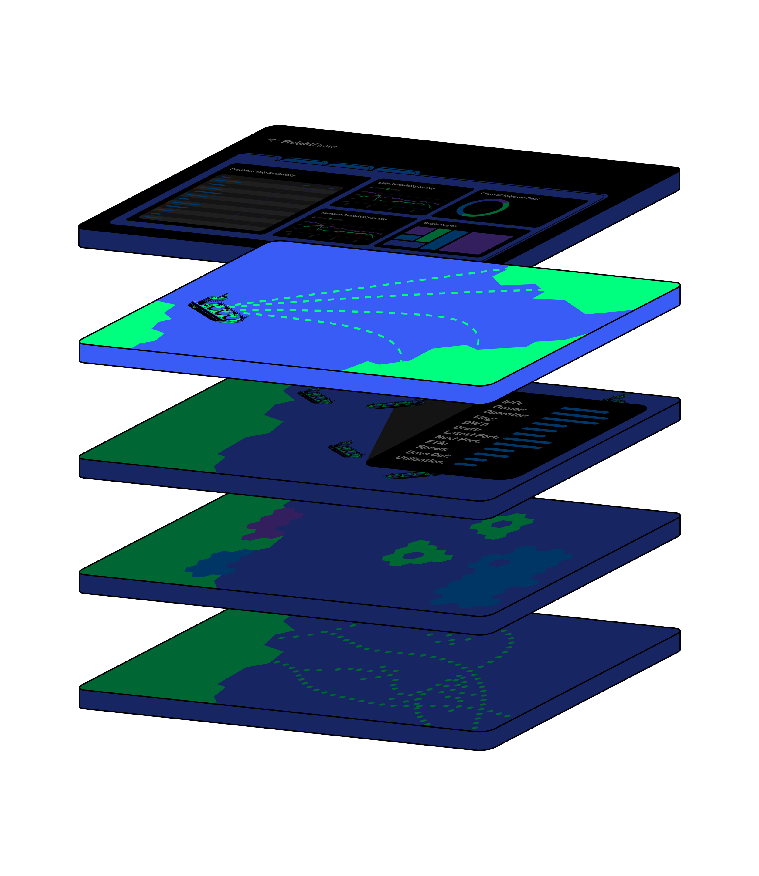
Polygon creation
Most data providers that automatically report on vessel arrivals or departures do so with low resolution, hand-made “geofences” for AIS positions. FreightFlows uses machine-made polygons to keep world maps up to date.
Filling the gaps of missing information
With so many different data sources, update frequencies and coverage areas, customers must navigate the never-ending issue of missing data. FreightFlows has built a data model that brings together all these disparate data sources and interpolates the missing data to help provide more accurate global views.
Models that account for all trades, vessel types, and geographies
Trades are interconnected, so our models are too. FreightFlows analytics are built on data science principles that account for all trades, ensuring that our market views incorporate influences from adjacent activity

OUR SOLUTION
Market intelligence to drive informed decisions

Instantly view granular and aggregate trade data
Navigate historical and predicted voyages
Track cargo flows
Accelerate decarbonization efforts
Frequently Asked Questions
-
FreightFlows leverages a vast collection of models to create our suite of predictions: Historical models for seasonality effects, current voyage models for predictive destinations and ETAs, and future models port stay and next port-of-call predictions.
-
FreightFlows has created a first-of-its-kind dynamic mapping algorithm for anchorages, ports and berths. By adjusting the granular polygons (geofences) with observed vessel behaviors, we can create highly accurate commercial operations data.